 |
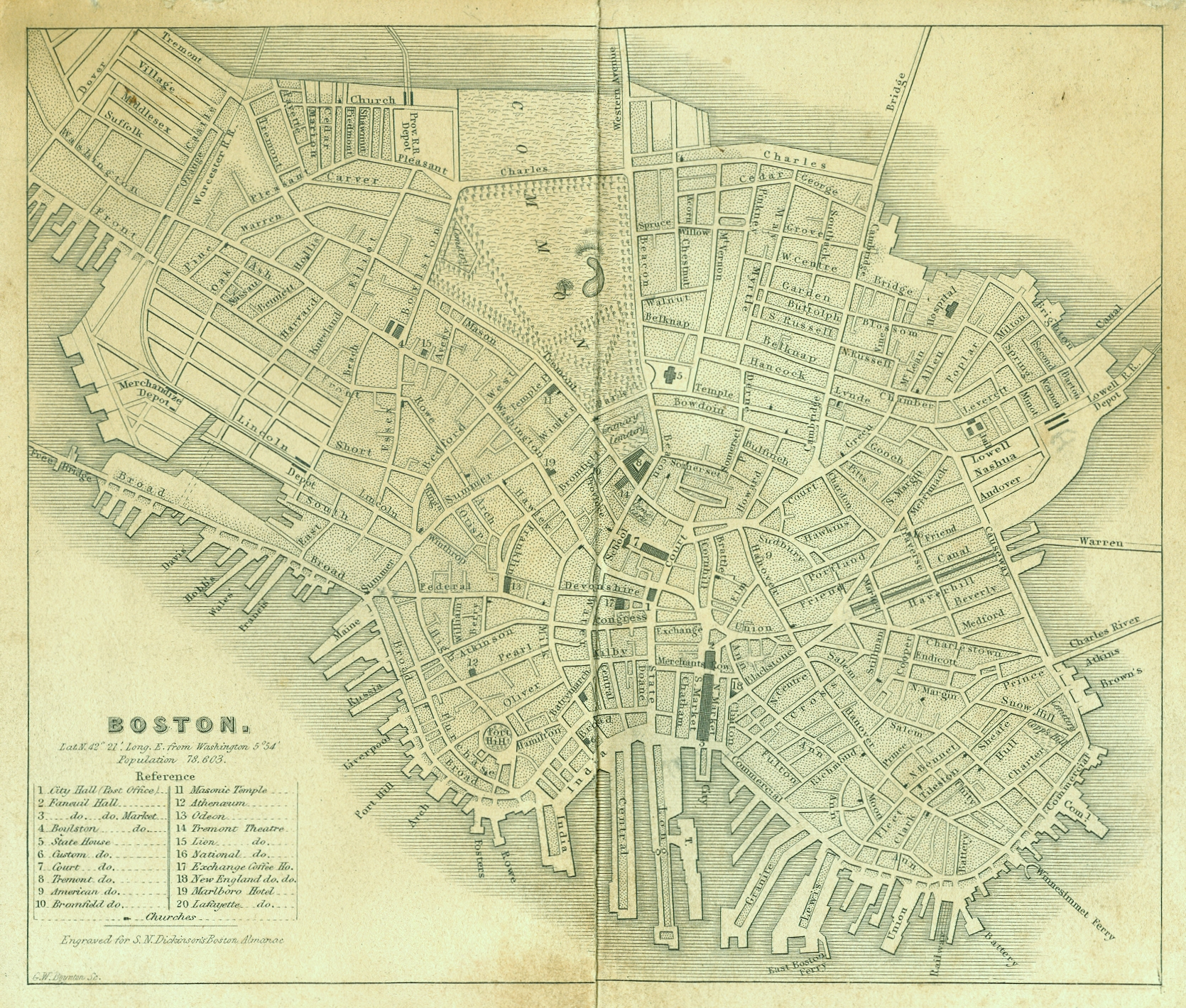
Boston Map, 1838

(Click on Map to View Full Size)
A map of Boston from 1838 looking west. The most interesting element of this map is how much area of the city had yet to be landfilled in. The Back Bay District is still a mud flat along the Charles River. The Charles River Basin and Esplanade areas are still under water. And noteworthy is that end of Broad Street hadn't been filled in, and the street ended at a bridge to South Boston (now part of Summer Street).
The reference table on the lower right is labeled as follows: (1) City Hall (Post Office), (2) Faneuil Hall, (3) Faneuil Hall Market, (4) Boylston [Street], (5) State House, (6) Custom [House], (7) Court [House], (8) Tremont [Hotel], (9) American [Hotel], (10) Bromfield [Hotel], (11) Masonic Temple, (12) Athenaeum, (13) Odeon [Theatre], (14) Tremont Theatre, (15) Lion [Theatre], (16) National [Theatre], (17) Exchange Coffee [House], (18) New England [Coffee House], (19) Marlboro Hotel, and (20) Lafayette [Hotel]. The population of Boston is also listed at 78,603.
In 1838, there were only four railroad depots located in Boston: (1) Boston & Worcester Railroad near today's South Station, (2) Boston & Worcester Merchandize Depot also near South Station, (3) Boston & Providence Depot at Pleasant Street (now Park Square), and (4) Boston & Lowell Depot at Nashua Street. Noticeably absent is the Boston & Maine Depot, which will be built soon at Haymarket Square.
Notice that King's Chapel at School Street is merely labeled as "Cemetery," and that the Snowhill Street Cemetery, just north of Copp's Hill Cemetery and across today's Hull Street, was not removed yet.
Use of the above image (1670x1420, 2.6 mb) is permitted with a credit of "Image [or Map]courtesy of CelebrateBoston.com."
Source: Boston Almanac, 1838